SIMD: Self-similarity Index Map for Multi-modal Remote Sensing Image Matching
SIMD: Self-similarity Index Map for Multi-modal Remote Sensing Image Matching
Abstract
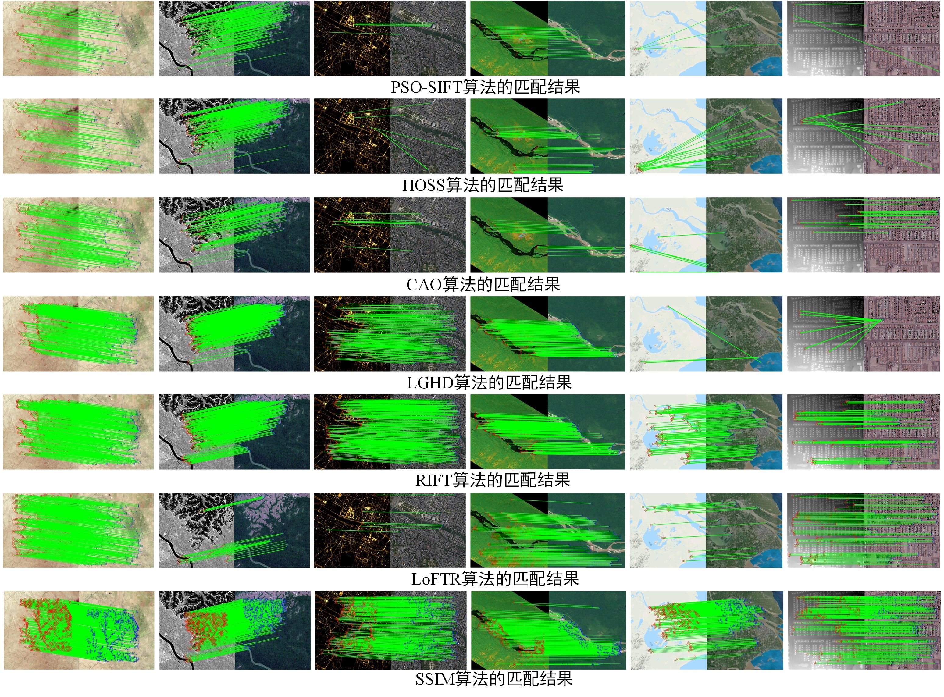
Geometric registration with point matches is the key to multi-modal remote sensing data fusion. However, the different imaging mechanisms of multi-modal remote sensing images (MRSIs) can lead to serious non-linear radiation distortion and significant differences in texture details, making the matching of MRSIs very difficult. In this paper, we propose a novel self-similarity index map (SSIM) based on the MRSI matching method. Our SSIM method includes an extended function to compute the sum of the square differences within an image window as the self-similarity value, a 3D gaussian convolution function to optimize the self-similarity structures and weaken the influence of the image noise, and a SSIM which obtains the stable and robust image features by calculating the maximum of the self-similarity indices. Our proposed SSIM method can deal with limited-scale differences and rotations and uses a coarse-to-fine strategy to obtain accurate corresponding points. A dataset with six types of MRSIs was used for verification. Our experimental results confirmed that our proposed SSIM method outperformed state-of-the-art methods as far as the number of correct matches, the ratio of correct matches, and the accuracy of the corresponding points. Executable programs of SSIM and MRSI datasets are published: https://skyearth.org/publication/project/SSIM/